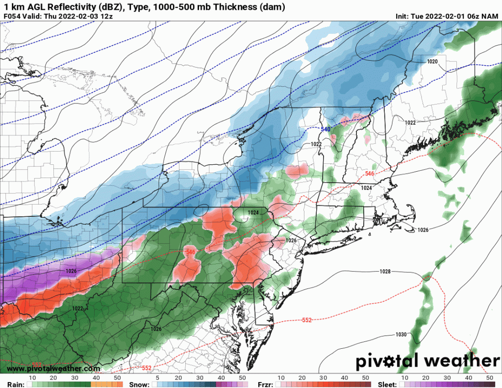
After much of the eastern US has gotten out of the deep freeze of the last few days, another storm is taking shape. This one will be more typical of winter with snow from the central Plains to the Great Lakes and Northeast US with rain and the potential for heavy thunderstorms from the Ohio Valley, the Virginias and the Carolinas, into the deep south. The storm will take 48-72 hours to move from the Rockies and Plains and depart New England by Friday night, leaving the Northeast bitter cold but dry this weekend, cold over the rest of the eastern US. This post is just a test. To see the video produced with this, go to the Meteorologist Rich Lupia Facebook Page, You Tube or Twitch Live.
Free step-by-step guide lorem ipsum dolor sit amet, consectetur adipiscing elit, sed do eiusmod tempor incididunt ut labore et dolore magna aliqua.
© 2022 Rich Lupia, Lupia & Associates, LLC. All Rights Reserved.
SITE DEVELOPED BY BROCKETT CREATIVE GROUP, INC