It will continue to be a beautiful day up and down the east coast from New England, Upstate NY and the Great Lakes, through the Mid-Atlantic, Ohio and Tennessee Valleys to Florida. With high pressure large and in charge, along with the high May sun angle, expect normal to slightly above normal temperatures. We’ll range from the 60s over the Norteastern US, 70s Mid Atlantic and Ohio Valley, 80s Southeast and Tennessee Valleys. But west of the Mississippi…
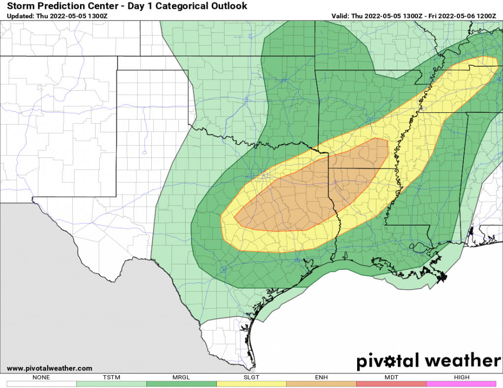
Trouble. Slow moving storm swirling from Oklahoma will move slowly east. With deep moisture and warmth pumping out of the Gulf of Mexico, it’s the typical recipe for intense thunderstorms with damaging winds, hail, and possible tornadoes. While there was some damage in Oklahoma yesterday from tornadoes, thankfully they were not as widespread nor as intense as feared. Today should hopefully follow the same script. If you are anywhere between Dallas, Memphis, St Louis and New Orleans… HEADS UP! Stay weather aware this afternoon and tonight, have ways to get warnings if issued, and take action if warned.
The severe weather threat moves east of the Mississippi Valley on Friday. Storms will fire tomorrow afternoon across Alabama, Georgia, eastern Tennessee, spreading into the Carolinas and up to central Virginia after dinnertime. The severe weather thre